%20--%3e%3csvg%20version='1.1'%20id='Layer_1'%20xmlns='http://www.w3.org/2000/svg'%20xmlns:xlink='http://www.w3.org/1999/xlink'%20x='0px'%20y='0px'%20viewBox='317%20258%20239%2089'%20preserveAspectRatio='xMinYMid%20meet'%20xml:space='preserve'%3e%3cstyle%20type='text/css'%3e%20.st0{fill:%23C9924A;}%20%3c/style%3e%3cpath%20class='st0'%20d='M430,343.4v2.2h-11.9v-25.9h4.3v23.7H430z'/%3e%3cpath%20class='st0'%20d='M449.5,332.9l-7.1,0l-4.1,12.7h-2.5l8.4-25.9h9.1l8.4,25.9h-8.1L449.5,332.9z%20M448.8,330.8l-2.9-9.2l-2.9,9.1%20L448.8,330.8z'/%3e%3cpath%20class='st0'%20d='M482.7,319.6v2.2h-6.8v23.7h-4.3v-23.7h-6.9v-2.2H482.7z'/%3e%3cpath%20class='st0'%20d='M507.4,337c0,2.2-0.5,3.9-1.4,5.3c-0.9,1.4-2.1,2.3-3.5,2.9c-1.4,0.6-2.9,0.9-4.4,0.9c-2.8,0-5.1-0.7-7-2.1%20c-1.8-1.4-2.8-3.7-2.8-7v-17.3h4.3V337c0,2.4,0.5,4.2,1.5,5.3c1,1.1,2.4,1.7,4.2,1.7c1.8,0,3.3-0.6,4.6-1.7c1.3-1.1,1.9-2.9,1.9-5.3%20v-17.3h2.5V337z'/%3e%3cpath%20class='st0'%20d='M554.9,343.4v2.2h-13.7v-25.9h12.9v2.2h-8.6v8.9h9.1v2.2h-9.1v10.5H554.9z'/%3e%3cpath%20class='st0'%20d='M530.5,332.9c0.5-0.4,0.9-0.8,1.2-1.3c0.7-1.2,1.1-2.6,1.1-4.2c0-2.1-0.6-4-1.9-5.5c-1.2-1.5-3.4-2.3-6.5-2.3%20h-8.7v25.9h4.3v-12.6h0v-11.6h3.9c1.5,0,2.6,0.6,3.4,1.8c0.7,1.2,1.1,2.6,1.1,4.4c0,1.5-0.4,2.9-1.1,4c-0.6,0.9-1.5,1.4-2.6,1.6h0%20l0,0c0,0,0,0,0,0h0l5.1,12.7h2.2l-5.1-12.7H530.5z'/%3e%3cpath%20class='st0'%20d='M398.4,332.9L398.4,332.9l0-11.6h3.9c1.5,0,2.6,0.6,3.4,1.8c0.7,1.2,1.1,2.6,1.1,4.4c0,1.5-0.4,2.9-1.1,4%20c-0.6,0.9-1.5,1.4-2.6,1.6l0,0.2l5.7,0c0.5-0.4,0.9-1,1.2-1.5c0.7-1.2,1.1-2.6,1.1-4.2c0-2.1-0.6-4-1.9-5.5%20c-1.2-1.5-3.4-2.3-6.5-2.3h-8.7v25.9h4.3V332.9z'/%3e%3cpolygon%20class='st0'%20points='391.3,260.1%20390.3,259%20361.2,288.1%20361.2,265.1%20359.7,265.1%20359.7,288.1%20330.6,259%20329.5,260.1%20357.6,288.2%20317.5,288.2%20317.5,291.7%20356.2,291.7%20334.1,313.7%20336.6,316.2%20359.7,293.1%20359.7,332.9%20361.2,332.9%20361.2,291.7%20380,310.5%20381,309.5%20363.2,291.7%20381.8,291.7%20381.8,288.2%20363.2,288.2%20'/%3e%3c/svg%3e)
%20--%3e%3csvg%20version='1.1'%20id='Layer_1'%20xmlns='http://www.w3.org/2000/svg'%20xmlns:xlink='http://www.w3.org/1999/xlink'%20x='0px'%20y='0px'%20viewBox='0%200%20841.9%20595.3'%20style='enable-background:new%200%200%20841.9%20595.3;'%20xml:space='preserve'%3e%3cstyle%20type='text/css'%3e%20.st0{fill:%23C9924A;}%20%3c/style%3e%3cpolygon%20class='st0'%20points='566.9,145.8%20562.9,141.7%20451.2,253.4%20451.2,165.1%20445.4,165.1%20445.4,253.4%20333.8,141.7%20329.7,145.8%20437.5,253.6%20283.5,253.6%20283.5,267.1%20432.1,267.1%20347.4,351.7%20356.9,361.2%20445.4,272.7%20445.4,425.2%20451.2,425.2%20451.2,267.3%20523.4,339.5%20527.5,335.4%20459.1,267.1%20530.5,267.1%20530.5,253.6%20459.1,253.6%20'/%3e%3c/svg%3e)
For municipalities
Wildlife data you can document.
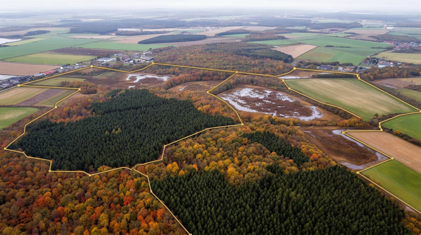
Plature already holds observation data from trail cameras across the country — including your municipality. You get continuous access via a dashboard: which species are detected where, at what time of day, and how activity develops. If a specific area needs denser coverage, we prepare cameras for the purpose.
Applications
Four tasks where early knowledge is cheaper than late action.
Nature restoration and protected areas
A baseline before the project starts and measured development afterwards. You get a comparable figure for species activity before and after the intervention instead of a professional estimate.
Fauna passages and roadkill
Documentation of which species actually use a passage, and how often. Used to prioritise where the next passage or fencing does the most good.
Invasive species
Raccoon dog, raccoon and wild boar spread faster than they can be recorded manually. Continuous camera coverage gives early indication of where a species appears and when it is active — that is the difference between preventing a population and fighting it afterwards.
Problem animals and citizen enquiries
When reports come in about wolves near housing, wild boar in the fields or repeated damage, continuous data gives a factual basis to act and answer on. You can see whether it is a single animal or a pattern, before the case becomes political.
Coverage
There is already data in your municipality.
Plature's camera network has been built over several years and covers the whole country. That means you do not start from zero: detections from your area already exist and can be made available immediately. Coverage density varies from municipality to municipality and from parish to parish — we show you exactly what exists in your area before you decide anything.
You get access to observation data — species, timestamp, location and activity index. You do not get the image files, and they are not part of the delivery.
How it works
From agreement to live data.
- 01
Access to your area
We define the municipality's area in the platform and open access to the observations that already exist. You log in and see data the same day the agreement is in place.
- 02
Continuous AI classification
New images are classified by species and time-stamped automatically as they arrive. Images containing people or vehicles are automatically replaced by a neutral image before anything is stored or shown. Processing takes place in a closed EU environment, and the municipality receives observation data — not image files.
- 03
Dashboard and export
Data sits in a dashboard with maps, species distribution, daily rhythm and development over time. You can pull raw data in CSV whenever you need it — no need to request a report and wait for it.
- 04
Extra coverage, if you need it
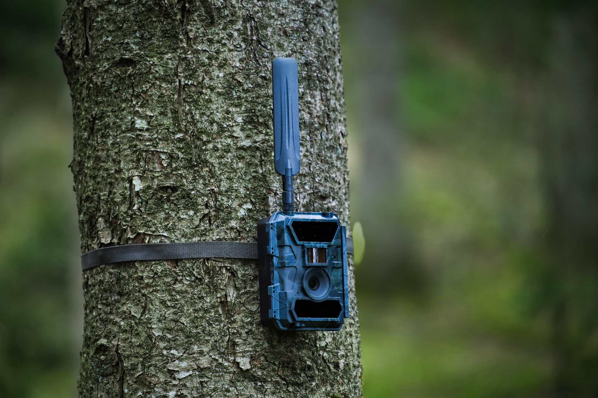
If cameras are missing at a specific site, we prepare and test them at our premises and ship them fully configured. They simply need to be hung up. Data is sent over the mobile network — there are no SD cards to collect and nothing to operate locally.
Method
What the number means.
Plature reports wildlife activity as detections per species per 100 camera-days. A camera-day is one camera in operation for one day. Dividing by actual operating time makes periods comparable, also when a camera has been down or moved.
- Development over time in the same area
- Comparison of two areas measured with the same setup
- Daily rhythm and seasonal variation per species
- Before and after a specific intervention
We state detection setup, camera density and operating time in every report, so your own specialists or an external adviser can assess the basis. If the result is to inform a formal management decision, we recommend combining camera data with a monitoring design prepared by a nature science adviser — we gladly contribute data to that.
Add-on
Does an area need denser coverage?
Most municipalities start with access to the data that already exists. If you have a specific area — a fauna passage, a restoration project or a site with repeated enquiries — where there are not enough cameras, you can add a project programme with fixed scope and fixed price.
- Duration
- 12 months
- Cameras
- 10 units, prepared, tested and configured by Plature — they simply need to be hung up
- Coverage
- One contiguous area designated by the municipality
- Reporting
- Continuous in the dashboard — not a quarterly report you have to wait for
- Data
- Raw data in CSV, pulled whenever you want. The municipality owns its data.
- Price
- DKK 50,000 excl. VAT for the entire programme
The price is fixed for the 12 months and is not index-adjusted along the way. If you want more cameras or more areas, the programme is extended at the same unit prices.
Talk to us about an area →Procurement
Practical when you need to order.
Direct purchase
Both data access and the project programme are priced to sit below the threshold for direct purchase of services. The project programme costs DKK 50,000 excl. VAT — well below the threshold for direct purchase of services. There is no tender obligation, and the agreement can be made on a single contract.
Invoicing
We invoice electronically via NemHandel to your EAN number with the requisition and account details you provide. Payment terms: 30 days net.
Contract basis
A two-page standard agreement plus a data processing agreement under GDPR Article 28 where relevant. Both can be sent to your legal adviser for review before you decide.
Plature ApS · CVR 38 73 24 20 · Vardevej 171, 7100 Vejle, Denmark
Data processing
The processing is documented and the roles are clear.
- The municipality receives observation data — species, timestamp, location and index. Image files are not part of the delivery.
- Images containing people or vehicles are automatically replaced by a neutral image as part of the processing. No personally identifiable images are stored.
- All processing and storage takes place in an EU-based Microsoft Azure environment with private endpoints and segmented network access.
- Data transfer from camera to platform runs over a closed connection with a dedicated APN — not via the public internet.
- Microsoft Azure is the only sub-processor.
- For project programmes, where the cameras belong to the municipality, the municipality is data controller and Plature is data processor. A separate data processing agreement under GDPR Article 28 is signed before the first camera goes into operation.
- For access to Plature's existing datasets, Plature is data controller for the collection. The municipality receives a processed product containing no personal data.
- The municipality may audit security arrangements once a year or on reasoned suspicion.
- On termination, the municipality's own data is deleted or anonymised, and the municipality can require written confirmation of it.
The municipality's own data is not part of other customers' deliveries and is not resold.
Reference
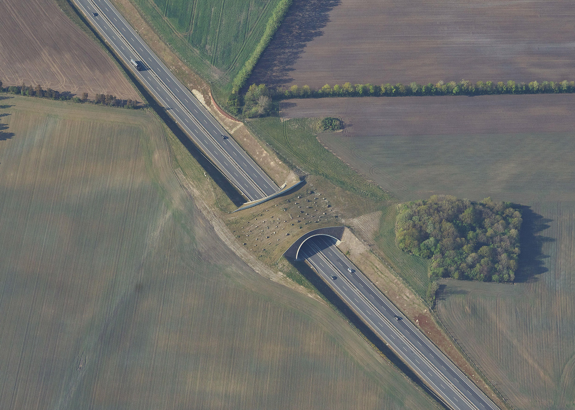
The Danish Road Directorate — camera monitoring of fauna passages
The Danish Road Directorate uses trail cameras to document which species actually use fauna bridges and underpasses on the state road network, and how often. Plature supplies the platform, AI species recognition and continuous data transfer into the Directorate's own IT environment.
See more use cases →Questions
What we are asked most often.
Do we have to operate the cameras ourselves?
No. Plature operates the platform, the data delivery and the AI processing. For project programmes we prepare and test the cameras at our premises, so they simply need to be hung up — there are no SD cards to collect, no software to install and no subscription to administer.
Do we receive the images?
No. You receive observation data: species, timestamp, location and activity index. The image files are not part of the delivery. It is both a legal and a practical boundary — it is the numbers that can be used in a case file, not the images.
How many cameras do you have in our municipality?
It varies, and we answer specifically. Write to us with the name of the municipality and we will come back with a picture of the actual coverage in your area, before you decide anything.
What happens if a camera captures a person?
The image is automatically replaced by a neutral placeholder image as part of the processing. No personally identifiable images are stored.
Can you tell us how many roe deer are in the area?
No. We deliver an activity index per 100 camera-days showing development and distribution. An absolute population figure requires a statistical monitoring design, which lies outside what we deliver.
Can we use the data in an administrative decision?
The data can serve as documentation of species occurrence and activity over time. If it is to carry a decision on its own, the method should be assessed by your own nature science adviser. We supply the documentation needed to make that assessment.
Who owns the data?
For project programmes the municipality owns the data from its own cameras and can pull it whenever it wants. For access to Plature's existing datasets the municipality receives a right of use to observation data for its area for as long as the agreement runs.
Does it have to go to tender?
Both data access and the project programme sit below the threshold for direct purchase of services. The municipality should of course verify this against its own procurement rules.
How quickly can we get started?
Access to existing data is opened as soon as the agreement is in place — typically the same week. For project programmes it takes three to four weeks from signature until the cameras are in operation.
Can we expand to more areas?
Yes. The programme is extended with more cameras or more areas at the same unit prices without a new agreement.
Contact
Tell us about the area.
Write the name of the municipality and what you would like to be able to see, and we will come back with a picture of the actual coverage in your area and a concrete proposal. We will not cold-call you afterwards.