%20--%3e%3csvg%20version='1.1'%20id='Layer_1'%20xmlns='http://www.w3.org/2000/svg'%20xmlns:xlink='http://www.w3.org/1999/xlink'%20x='0px'%20y='0px'%20viewBox='317%20258%20239%2089'%20preserveAspectRatio='xMinYMid%20meet'%20xml:space='preserve'%3e%3cstyle%20type='text/css'%3e%20.st0{fill:%23C9924A;}%20%3c/style%3e%3cpath%20class='st0'%20d='M430,343.4v2.2h-11.9v-25.9h4.3v23.7H430z'/%3e%3cpath%20class='st0'%20d='M449.5,332.9l-7.1,0l-4.1,12.7h-2.5l8.4-25.9h9.1l8.4,25.9h-8.1L449.5,332.9z%20M448.8,330.8l-2.9-9.2l-2.9,9.1%20L448.8,330.8z'/%3e%3cpath%20class='st0'%20d='M482.7,319.6v2.2h-6.8v23.7h-4.3v-23.7h-6.9v-2.2H482.7z'/%3e%3cpath%20class='st0'%20d='M507.4,337c0,2.2-0.5,3.9-1.4,5.3c-0.9,1.4-2.1,2.3-3.5,2.9c-1.4,0.6-2.9,0.9-4.4,0.9c-2.8,0-5.1-0.7-7-2.1%20c-1.8-1.4-2.8-3.7-2.8-7v-17.3h4.3V337c0,2.4,0.5,4.2,1.5,5.3c1,1.1,2.4,1.7,4.2,1.7c1.8,0,3.3-0.6,4.6-1.7c1.3-1.1,1.9-2.9,1.9-5.3%20v-17.3h2.5V337z'/%3e%3cpath%20class='st0'%20d='M554.9,343.4v2.2h-13.7v-25.9h12.9v2.2h-8.6v8.9h9.1v2.2h-9.1v10.5H554.9z'/%3e%3cpath%20class='st0'%20d='M530.5,332.9c0.5-0.4,0.9-0.8,1.2-1.3c0.7-1.2,1.1-2.6,1.1-4.2c0-2.1-0.6-4-1.9-5.5c-1.2-1.5-3.4-2.3-6.5-2.3%20h-8.7v25.9h4.3v-12.6h0v-11.6h3.9c1.5,0,2.6,0.6,3.4,1.8c0.7,1.2,1.1,2.6,1.1,4.4c0,1.5-0.4,2.9-1.1,4c-0.6,0.9-1.5,1.4-2.6,1.6h0%20l0,0c0,0,0,0,0,0h0l5.1,12.7h2.2l-5.1-12.7H530.5z'/%3e%3cpath%20class='st0'%20d='M398.4,332.9L398.4,332.9l0-11.6h3.9c1.5,0,2.6,0.6,3.4,1.8c0.7,1.2,1.1,2.6,1.1,4.4c0,1.5-0.4,2.9-1.1,4%20c-0.6,0.9-1.5,1.4-2.6,1.6l0,0.2l5.7,0c0.5-0.4,0.9-1,1.2-1.5c0.7-1.2,1.1-2.6,1.1-4.2c0-2.1-0.6-4-1.9-5.5%20c-1.2-1.5-3.4-2.3-6.5-2.3h-8.7v25.9h4.3V332.9z'/%3e%3cpolygon%20class='st0'%20points='391.3,260.1%20390.3,259%20361.2,288.1%20361.2,265.1%20359.7,265.1%20359.7,288.1%20330.6,259%20329.5,260.1%20357.6,288.2%20317.5,288.2%20317.5,291.7%20356.2,291.7%20334.1,313.7%20336.6,316.2%20359.7,293.1%20359.7,332.9%20361.2,332.9%20361.2,291.7%20380,310.5%20381,309.5%20363.2,291.7%20381.8,291.7%20381.8,288.2%20363.2,288.2%20'/%3e%3c/svg%3e)
%20--%3e%3csvg%20version='1.1'%20id='Layer_1'%20xmlns='http://www.w3.org/2000/svg'%20xmlns:xlink='http://www.w3.org/1999/xlink'%20x='0px'%20y='0px'%20viewBox='0%200%20841.9%20595.3'%20style='enable-background:new%200%200%20841.9%20595.3;'%20xml:space='preserve'%3e%3cstyle%20type='text/css'%3e%20.st0{fill:%23C9924A;}%20%3c/style%3e%3cpolygon%20class='st0'%20points='566.9,145.8%20562.9,141.7%20451.2,253.4%20451.2,165.1%20445.4,165.1%20445.4,253.4%20333.8,141.7%20329.7,145.8%20437.5,253.6%20283.5,253.6%20283.5,267.1%20432.1,267.1%20347.4,351.7%20356.9,361.2%20445.4,272.7%20445.4,425.2%20451.2,425.2%20451.2,267.3%20523.4,339.5%20527.5,335.4%20459.1,267.1%20530.5,267.1%20530.5,253.6%20459.1,253.6%20'/%3e%3c/svg%3e)
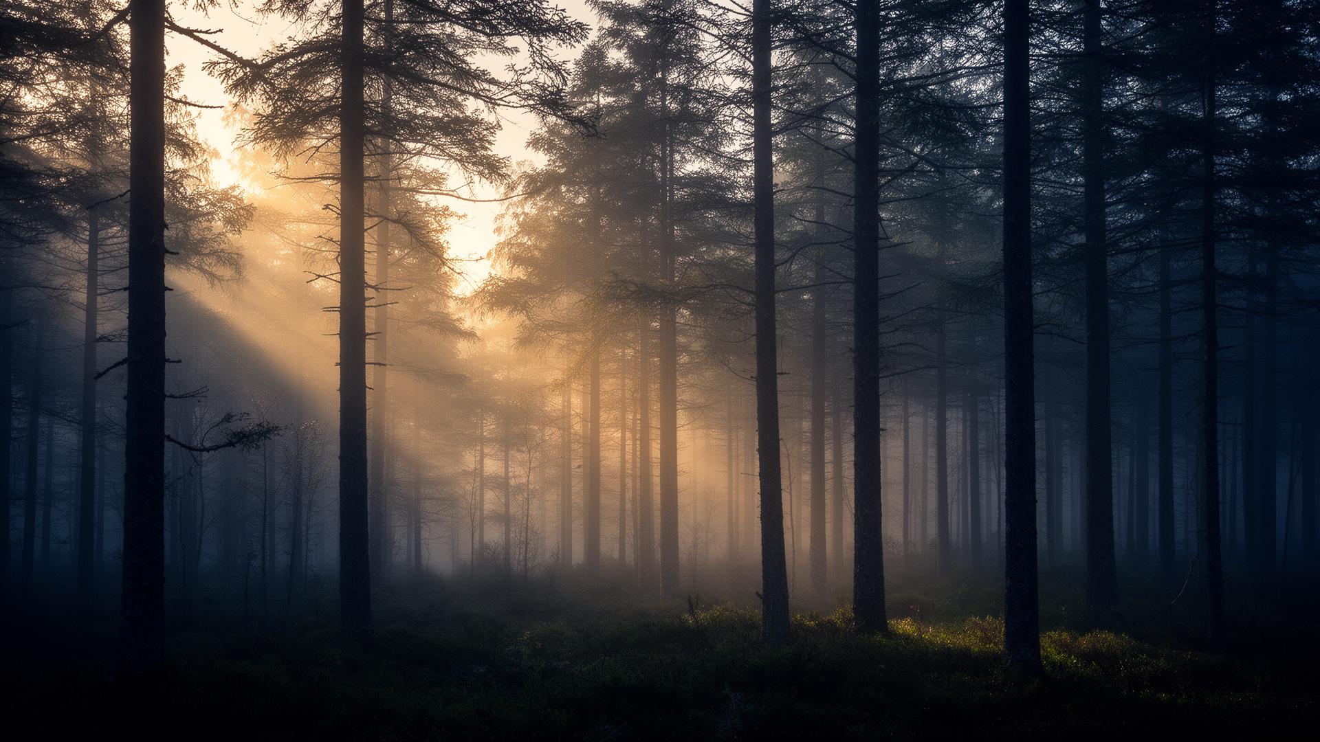
Nature embraced
When nature is monitored seriously,
data becomes insight.
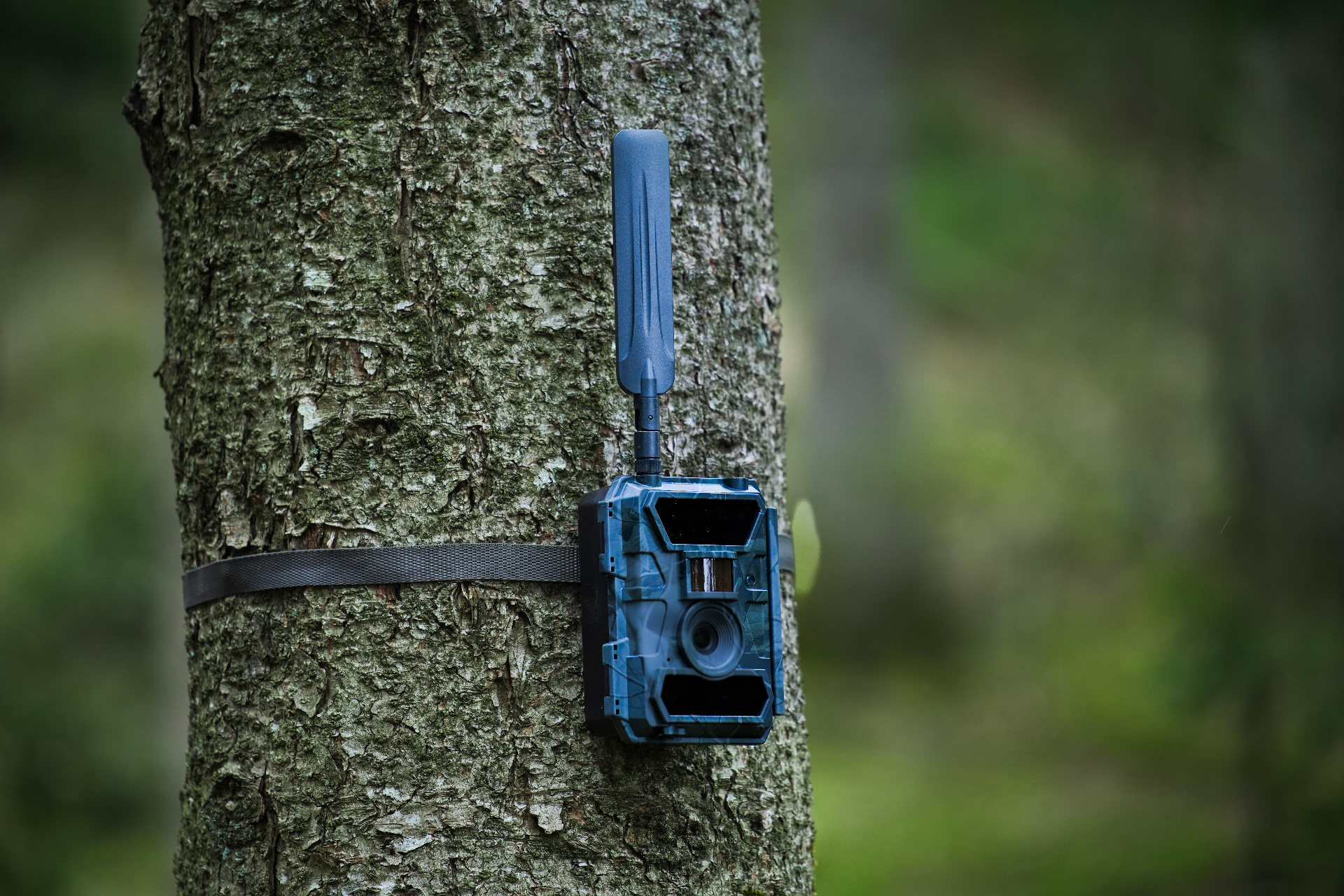
Plature builds distributed camera networks and AI-based species recognition — turning them into structured biodiversity data for biologists, land managers, researchers and hunters.
Two product tracks
Same foundation.
Two audiences.
Distributed trail-camera networks, AI-based species recognition and structured observations. Built by experts — delivered as a professional field tool and a scalable data platform for research and management.
The wildlife management app
Scales from the single hunter to consortia of 2,000+ hectares. Built for those who take sustainable wildlife management seriously.
See Jäger →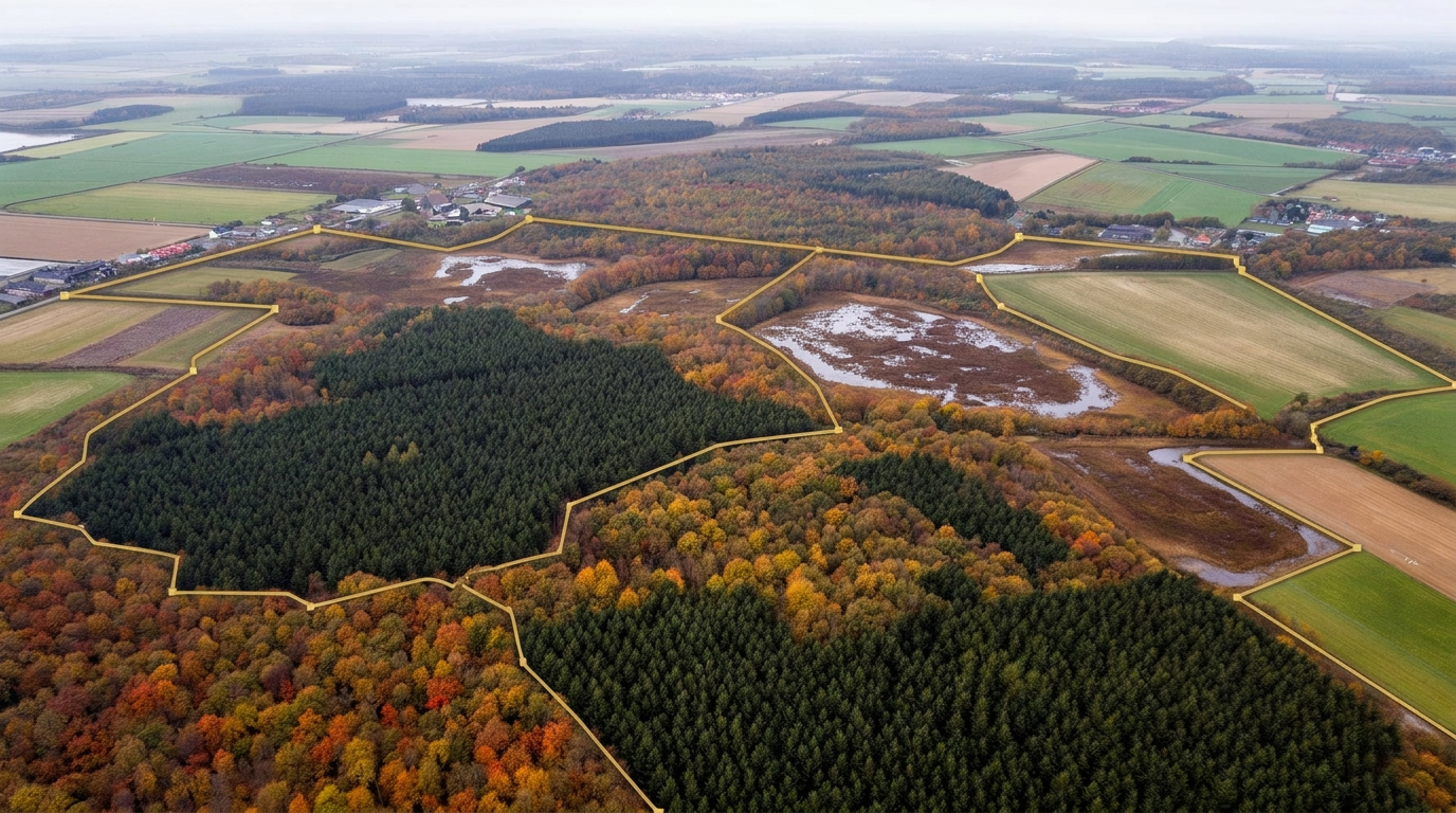
For biologists & management
Large-scale data platform for regional and national biodiversity monitoring — AI species recognition, API access and area-based aggregation.
See the platform →Use cases
A data foundation
used in the field.
Plature is used in biodiversity work, conflict management, nature restoration and documentation around major infrastructure projects.
Biodiversity
Species occurrence and trends over time — continuous documentation of the state of nature.
Conflict & risk
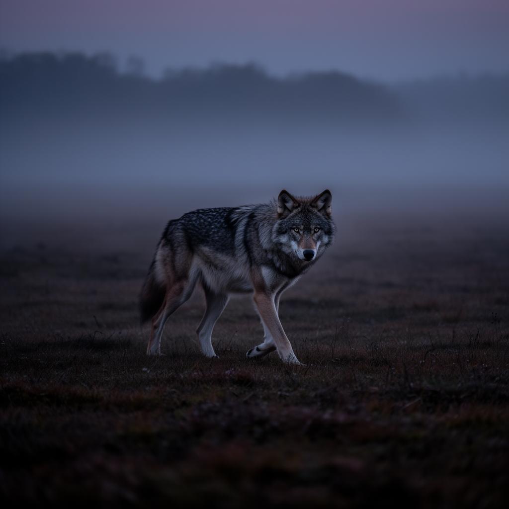
Monitoring of wolves near urban zones, invasive species and damage to game or crops.
Restoration & rewilding
Baseline and before/after documentation of species activity in project areas.
Infrastructure
Fauna passages, roads, wind and solar projects — continuous environmental documentation.
Invasive species
Early indication of unwanted species and their spread in selected areas.
Area-based insight
Aggregation per municipality, project area or grid — ready for analysis and reporting.
By the numbers
A growing data set on Danish nature.
Primarily Danish coverage, with supplementary trail-camera networks in Sweden.
From field to research
Nature,
continuously measured.
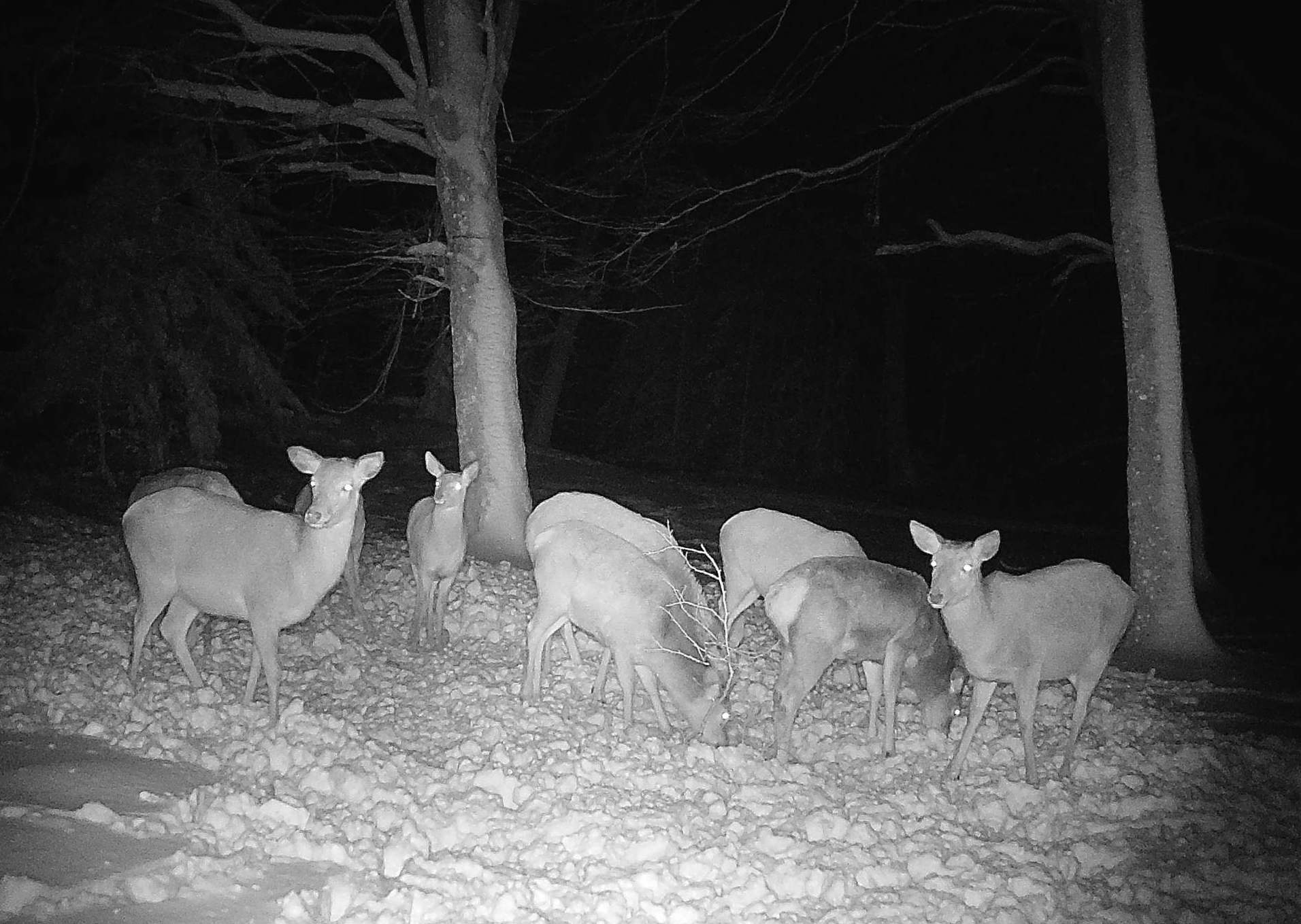
Thousands of trail cameras continuously deliver imagery from Danish nature. Plature's AI pipeline classifies species, georeferences observations and aggregates them into biodiversity data and fauna time series — ready for biologists, municipalities, agencies, NGOs and research projects.
- Raw imagery → AI species identification
- Timestamp + GPS → structured observations
- Aggregation per area → fauna time series
- Export via API → research and management
Get started
Let's talk about your area.
Consortia, municipalities, research projects or the individual manager — we design a solution that fits the scale.